- >
- Modules
- >
- >
- Grayscale Reconstruction / Reconstruction By Erosion
Module: Grayscale Reconstruction / Reconstruction By Erosion ()
Reconstruction By Erosion is one of the configurations of the module Grayscale Reconstruction. For other configurations, see the port Type.
This module can be used to remove the dark points in a light image. It performs a dual numerical reconstruction from a grayscale marker image into the grayscale input image. It is based on Reconstruction By Dilation.
At each step the marker image is eroded by a structuring element of size 1. This algorithm is based on a recursive method whereby the maximum of the eroded image and the mask image is retained and used as the marker image at the next step. This operation is repeated until stability. The number of iterations depends on the input image and the marker image. As shown in the figure 1, the valleys are levelled up, which results in a much more homogeneous output image.
This algorithm is used by the H-Minima algorithm.
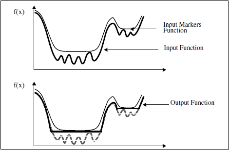
Figure 1: 1D example of the Reconstruction By Erosion See also: Reconstruction By Dilation, Watershed, Catchment Basins, Add To Label, Fill Label Boundaries.
Input Image [required]
The image to be reconstructed. Supported types are: grayscale/color image (Uniform Scalar Field/Uniform Color Field), binary (Uniform Label Field with 2 labels) and label image (Uniform Label Field).Input Marker Image [required]
The image of markers for reconstruction starting point. Supported types are: grayscale/color image (Uniform Scalar Field/Uniform Color Field), binary (Uniform Label Field with 2 labels) and label image (Uniform Label Field). Compatibility of input image and marker image types is required:
- grayscale 8-bit or 16-bit input image requires grayscale 8-bit or 16-bit marker image;
- grayscale 32-bit input image requires grayscale 32-bit marker image;
- grayscale floating point input image requires grayscale floating point marker image;
- binary or label input image requires binary or label input image.
Type
This port selects the configuration of this module. The available configurations are:Interpretation
This port specifies whether the input will be interpreted as a 3D volume or a stack of 2D images for processing.
- "3D": the module configuration is set to 3D. The image will be processed as a whole in 3D.
- "XY planes": the module configuration is set to 2D. The image will be processed slice per slice.
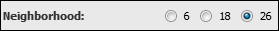
Neighborhood
In 3D configuration, this port refers to the type of connectivity considered for processing adjacent voxels:
- 6: voxels with a common face are considered connected
- 18: voxels with at least one common edge are considered connected
- 26: voxels with at least one common vertex are considered connected