- >
- Modules
- >
- >
- Expand Labels / Fill Label Boundaries
Module: Expand Labels / Fill Label Boundaries ()
Fill Label Boundaries is one of the configurations of the module Expand Labels. For other configurations, see the port Type.
For an introduction, see:
This module performs a constrained dilation of a label image. Its first aim is to expand labels obtained by using Marker-Based Watershed / Catchment Basins, so that all black pixels of the boundaries are filled with the value of the most present label among the height neighbors.
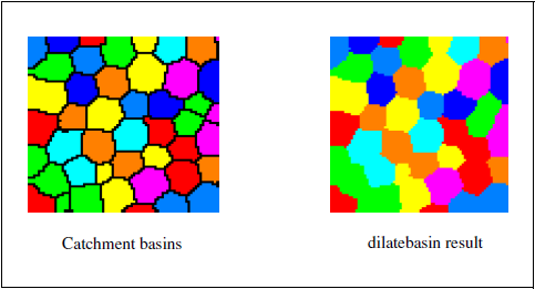
Figure 1: Example of Fill Label Boundaries applied to the result of Marker-Based Watershed / Catchment Basins See also: Watershed, Catchment Basins, Reconstruction By Dilation, Reconstruction By Erosion, Add To label.
Input Label Image [required]
The image of labels to be dilated. Supported type is: label image (Uniform Label Field).
Type
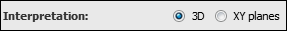
This port selects the configuration of this module. The available configurations are:Interpretation
This port specifies whether the input will be interpreted as a 3D volume or a stack of 2D images for processing.
- "3D": the module configuration is set to 3D. The image will be processed as a whole in 3D.
- "XY planes": the module configuration is set to 2D. The image will be processed slice per slice.
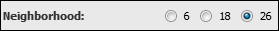
Neighborhood
In 3D configuration, this port refers to the type of connectivity considered for processing adjacent voxels:
- 6: voxels with a common face are considered connected
- 18: voxels with at least one common edge are considered connected
- 26: voxels with at least one common vertex are considered connected